Wednesday, June 15, 2016

Hope

Hope, as in the town of Hope.  At the base of Mt. Hope.

We left Campbell River this morning around 8 am to catch the ferry from Nanaimo (Discovery Bay) to Vancouver (Horseshoe Bay).  Here we are in line at the ferry terminal.


And on board.


A view of Vancouver from the ferry.  Just a tad overcast though.


When we got off the ferry, we drove through West Vancouver, North Vancouver, Vancouver, and a whole whack of cities on the lower mainland - Burnaby, Coquitlam, Surrey, and I don't even know what else.  Lots of independent cities.  It's certainly a busy area.  This is the Port Mann Bridge over the Fraser River in Surrey.  A toll bridge, I might add.


Driving along heading toward the Cascade Mountains.  The greater Vancouver area is a low flatland due to the delta of the Fraser River.  But as we approach the mountains, there is farmland surrounded by mountains.  What a beautiful spot to live.


We arrived at our destination, Hope, around 2:30.  Nice little spot.  When you look out the window above the trees, you expect to see sky.  But not here.  You see the wall of a mountain.  And mountains are all around us.  There was a landslide here near the town in the 1960s where 4 people lost their lives.

We went for a relatively short hike to Flood Falls.  You can barely see it running down this mountain (bottom 1/3 of the photo).


Here it is while we're standing at the foot of it.


While walking through the forest to get to the falls, we saw these trees covered in moss.  All the rain, I guess.


 Another mountain as we walked back to our RV park.


We would love to be driving up the Trans Canada Highway through the Fraser River canyon tomorrow to Kamloops, but with the RV we're not going to do that.  It's a sort of crazy, scary drive in a car let alone having an RV behind us, even though it's beautiful.  We're going to take Hwy 5 instead and meet the TC there.  Looking forward to the drive (don't know about Gerard).

Tuesday, June 14, 2016

Lots to Do on the Island

We got up today to a nice, fairly clear, morning.  But we knew we had to get our hiking in before the rain, because it was on its way.

So we went out to Elk Falls Provincial Park.  It is not far from our RV park, and right next to the power plant, and these big culverts run from the river to the plant for power generation.  We're standing on a bridge over the culverts, and on a path to the river.


Here is Elk Falls.

And lEk Falls from the suspension bridge.


The suspension bridge was just completed last year.


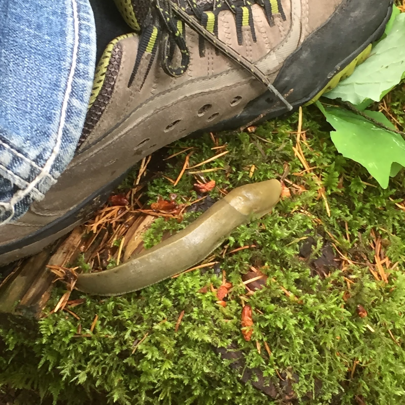
After we were done here, we went off on a trail down toward the power plant which ran for about a km and a half, or so.  Another one of those big slugs.


And big trees.

Nice path though.

Before we were finished, the rain started, and it was coming down pretty good.  Fortunately, we took our umbrellas along.  We're sure glad we did.

It did clear up later for a while.  We went out for a short walk.  Just up the road from us is an Indian cemetery.  Interesting.


This is our last night on Vancouver Island.  So we decided we'd go out for dinner.  We really haven't done that the whole time we've been away.  We went to the Harbour Grill, just down the road from where we are.  It was recommended to us.  Wonderful restaurant, with a great view.  I mentioned we're on the route of the Alaska cruise ships' inside passage.  Here's the MS Volendam, a Holland America Line ship, heading south, right outside our restaurant window!


There's lots to do on this Island, but not enough time!  Tomorrow we head back across to the mainland, and start our eastward trek home, with a few stops in-between.


Monday, June 13, 2016

Campbell River

This morning we packed up and left around 9:30 to head back over to the east side of Vancouver Island.  Back over that twisty, turny road.  This was taken kind of behind as we were flying by.


This is Cathedral Grove again...that area where you can walk among the huge trees and where they're so close to the road.

We arrived in Campbell River around 1:30, got all set up while the weather was quite nice -- sunny and warm, then it started to rain.  It rained for quite a while, so we watched the Blue Jays.  The rain let up, so we thought we would head out for a bit of a walk around.  We're on a spit that makes up one side of the mouth of the Campbell River.  The ocean side is the Tyee Pool where you can only catch fish with a manually-propelled boat, and with no modern lures or devices of any kind.  We'd never seen a sign like this before, but then, we're not around harbours and the like that often.


We're standing on the end of the spit here, looking up the Campbell River.


A nice serene place.  The ocean side is part of the Georgia Strait between the mainland and the Island.  The Alaska cruise ships go right by us, apparently, on the inside passage.  We'll see if we see any.

Well, it started raining again, and it's supposed to go on all night.  Kind of dreary, just like the Blue Jays game.

Biking and Hiking

Another evening of no internet.  Sorry folks.

The night of June 11, we went to the beach to look for the sunset, but it was more over the trees as opposed to over the water.  So it wasn't great.  And also because we had spent some time having drinks with people we just met who are from Brockville.  We were kind of late getting going to the beach.  Here's Tibby.  He likes running on the beach.


(June 12):  This morning we took our bikes into Tofino to do some more ditzing around.  It's about 3 km to the town, so that, plus return, plus ditzing meant we put on about 8-9 km, we would guess.  It's about time we made use of these bikes we've hauled all the way out here.  We have used them a couple of times, but not as much as today.

We stopped at the Eik Cedar.  There's a story behind this tree - the oldest "resident" in Tofino.  It was to be cut down several years ago because of insurance issues, but some people didn't want it cut.  So an arborist came in and provided a stabilization method, as you can see by the braces.  That was 14 years ago, and it's still there, but not sure for how long.  The top is beginning to die.


We see these every so often along the way.  I can imagine.  As I mentioned before, Japan is just across the water.

 After lunch, we went back to Pacific Rim National Park to do another hike out to South Beach.  Not quite the same South Beach we've been on before.

Great path for 200 metres or so up the grade and through an arbor arch.


Love the sign.  I think I've seen Brianna and Taylor do this on stage!  Or something similar.


So this is South Beach.  It was a calm day on the ocean, but apparently the waves in here can be absolutely dangerous - you wouldn't even want to be on the beach.  It's a narrow cove and the water is forced to go somewhere when it rolls in.


This is looking up Wickaninnish Beach.  All along this part of the peninsula are some great beaches.  Unfortunately, the weather is never very warm at any time, and the water is cold.  There are lots of surfers around, but they all wear wetsuits.


We're not sure if this is a banana slug, or not.  They can grow up to 25 cm in length.  But it could be a small/young one.  Eeewww.


So this is our last night here.  We're off to Campbell River tomorrow, on the northeast side of the Island.

Sunday, June 12, 2016

Tofino and Pacific Rim National Park Reserve

Yesterday (June 11):  Quite a pleasant day today.  There was no rain.  Apparently very few no-rain days here.  Something like 350 inches of rain a year, on average.  That's almost an inch a day (2.5 cms).

This morning we went into Tofino, which is only about 3 km up the road.  We picked up a few things at the Co-op (grocery) store and that other store we visit now and then.  We stashed everything in the truck, then took a stroll around town.

Talk about hippies.  This must be the hippy capital of Canada - young and old.  Even a hippy-mobile, or 2.

I thought this ended up at Campbell River, but I guess Tofino can claim this status too.  We certainly can't go any further.  We're at the end of a peninsula.


Seaplane harbour.

Can't launch any boats from here!  You'd have a hard time putt-putting on the mud.  (Tide's out.)


Gerard imitating an Indian woman crying (as the plaque says).  Well, Gerard isn't on the plaque.


We then went further down the road to the Pacific Rim National Park.  They have some nice trails you can do.  We first stopped at Incinerator Rock.  I don't recall ever seeing a sight like this - the huge rock is in the middle of the beach - and a couple more off-shore.


There were some people surfing here.  Then we saw it!  A whale spout!  Then the backs, then more spouts.  There are often grey whales here in this bay, we just didn't expect to see them!  Of course I can't get a photo -- too far away for this camera, and you never know when they're going to spout.

So then we carried on to do a trail in the Pacific Rim National Park.  It's called the Rainforest Trail.  You walk around on this trail and just keep saying "Wow".  The trees are so big and you'd think you were in a jungle somewhere for all the lush plants and trees growing.  Except it's much cooler, of course, which apparently is why these trees grow like this.


Trying to get shots to give perspective of size is really difficult.  So comparing them to something or someone helps.  These are 2 different trunks.


After they fall, they become "nurse trees".  Small trees take root and start growing out of the old log.  Here's an example of how that works in the photo below.  And once the old log has completely decayed, the roots of the new tree have a hole underneath, or the tree looks like it's standing on stilts.  I guess it takes 300-400 years for that process to happen.


There were signs everywhere about this.  But we didn't see any wolves.


We saw this creature, though.  I guess it's common out here.
There is one slug called a banana slug that's huge.  I was looking for one, but didn't see any.

After lunch, we headed back toward Tofino and did the Tolquin Trail out near the ocean.  Beautiful views.


And we found this little cove.  Very secluded.


It was a great day in Tofino and area.


Friday, June 10, 2016

Furthest Point West

This is it!  We've arrived at the furthest western point of Canada...well, as far as we're going anyway.  We're in Tofino on Vancouver Island.  We're about 100 steps from Mackenzie Beach on the Pacific Ocean.  Nothing but Japan over yonder.

We left our RV park this morning on the eastern side of the Island around 9:30 and had quite the drive through the middle.  A twisty, turny, sometimes narrow road that cuts through the mountains in the middle of the Island.  And all that was after we had to use the 4-wheel drive to get the RV up the hill from our RV park.  It was pretty steep.  Tires would be spinning otherwise.

Part of the trek involved going through this forest of giant trees.  It was pretty awesome.  They were so close to the road.

Port Alberni is the last town until the coast, driving west.  I kind of cut off the "Port Alberni" part.


Nice sign, but apparently, as we heard yesterday, Port Alberni is near the bottom of all the places to live in Canada.

There was this great river we followed for a while...Ellis River, I think.  This was a great spot with huge rocks to climb around, if you wanted.


These 2 pics are some of the windy, twisty stuff.

 
And this is Mackenzie Beach and we're facing southwest.  Lots of little islands just off-shore.


You can tell the tide is out right now.  This is looking pretty much west.


And our RV set up for the next 3 days.


We'll explore Tofino and this area tomorrow.